 Español

R+D+i
Our commitment to R+D+i guarantees the continuity of the business model, innovative and technologically advanced.
Since 2011, AENOR has certified our System for Management of R+D+i pursuant to regulation UNE 166002 for the activities of research, development and innovation in:
- Building technology for engineering and pavement conservation
- Communication and information technology
- Digital image process
- Fleet management
- Inventory management for roads and airports pavements
- Computer science application for management systems


Project development
- Interior, developing new products
- Collaborative, with sector companies and/or university
R+D+i consulting
- Financing
- Presentation and monitoring projects
- Looking for partners and PRO (Public Research Organisation).
Technology watch
- Expert management systems
- Survey techniques
- Artificial vision techniques
INNOVATION
"If you are seeking different results, do not always do the same thing." Albert Einstein


EXPERT MANAGEMENT OF URBAN PAVEMENT
ICARO CITY offers the data to analyze them easily: structural packaging, survey performed, traffic, geometry… It allows, through quality thresholds, create homogenous segments and know the state indices and planning of actions to perform for the expected evolution of the roadway and the available budget.
GENERATION OF ROUTES AND FLEET CONTROL
It allows generation of routes according to parameters such as the bearing capacity, the clearance existing at each point, etc. It allows monitoring the fleet of vehicles, and may add information on when they are stopped, active, etc.
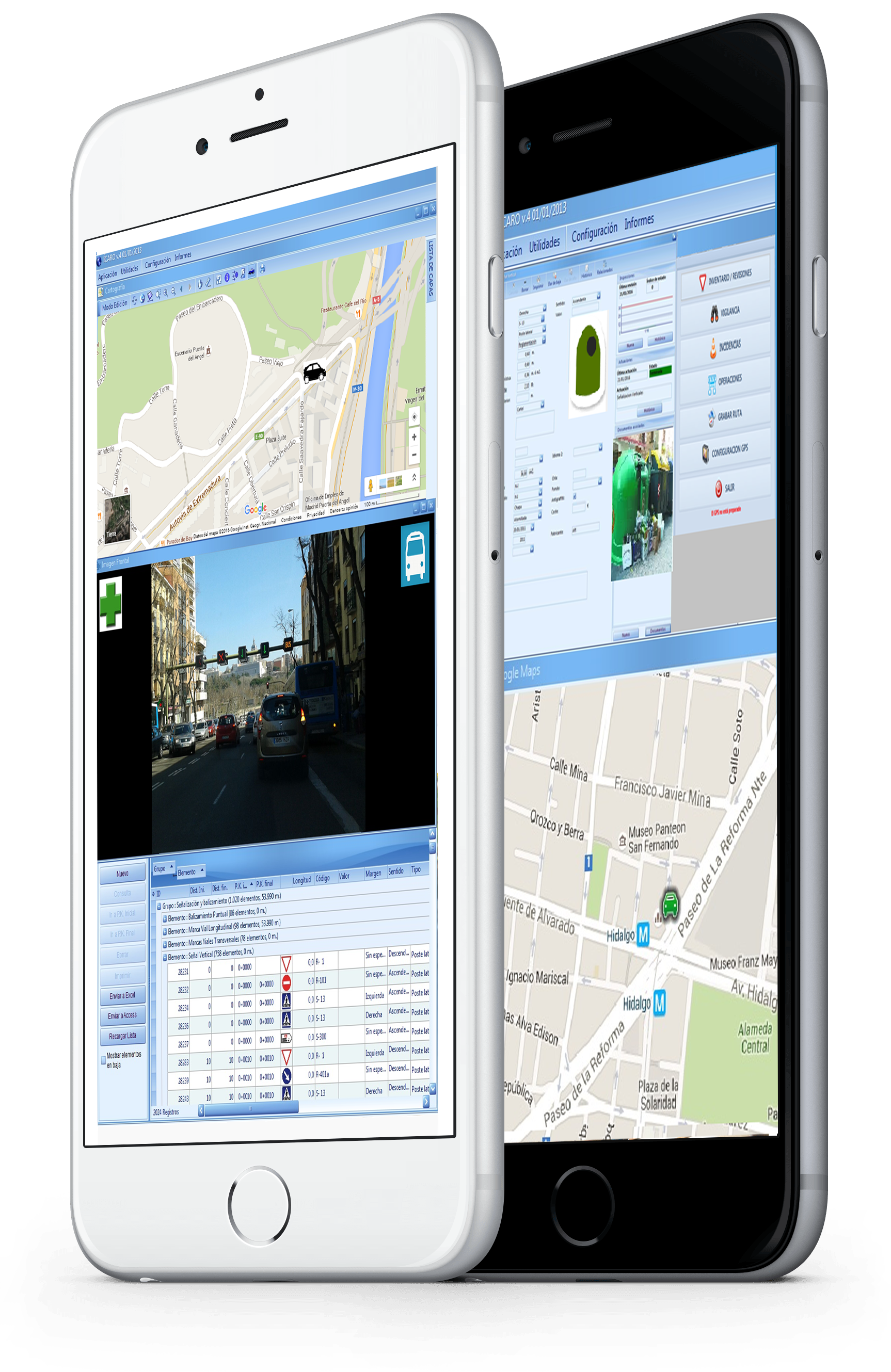
INVENTORY OF URBAN ASSETS
It contains the cards for each inventory asset with its specific attributes and index of status of the asset. It facilitates management of assets for intelligent cities, according to UNE 178303:2015.
ACCESIBILITY ANALYSIS
The inventoried assets may be evaluated according to accessibility parameters. It will allow representing thematics with: Points of reduced accessibiliity and architectural barriers.
SIMPLE VISUALIZATION
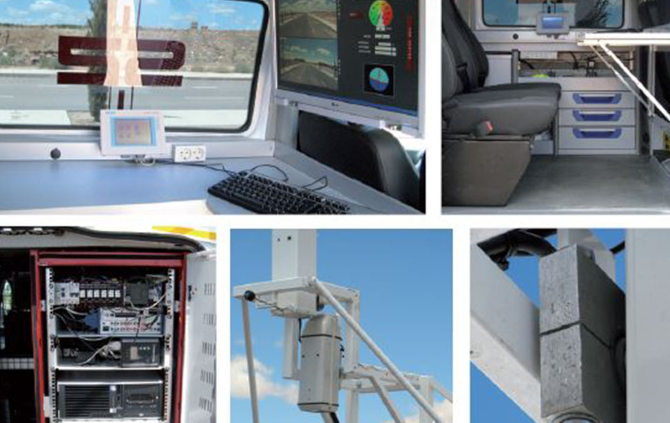
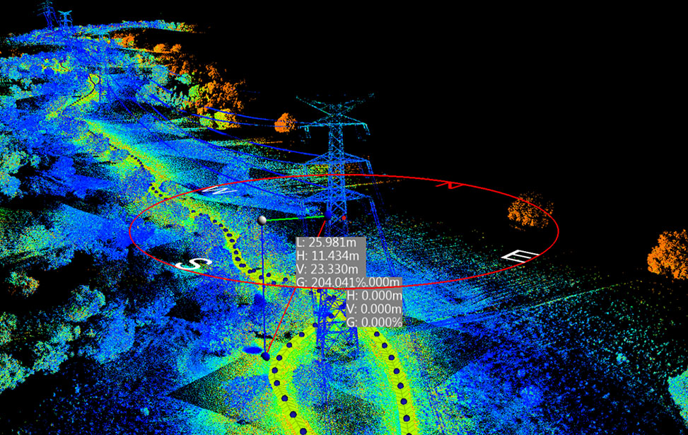
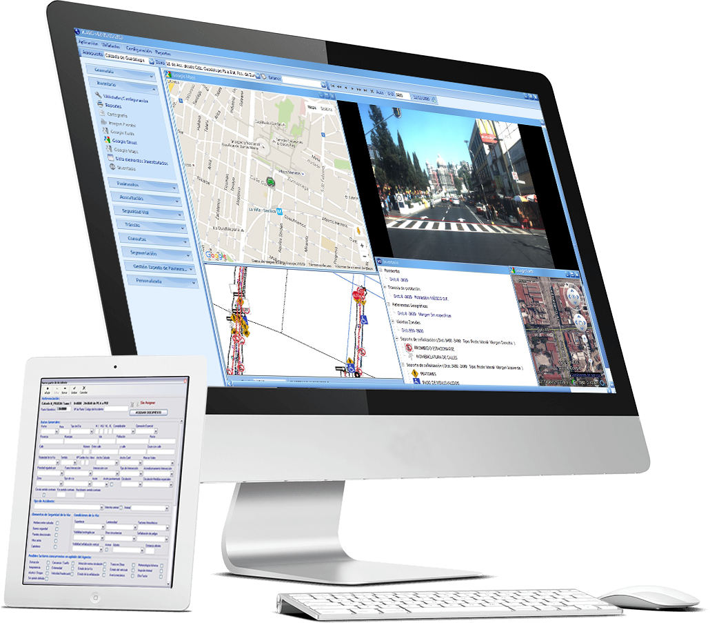
The system supports and shows 360º images and points cloud, and geolocalizes elements in cartography (Ortophotos, Google Maps, Google Earth, Google Street View…).
MULTIPLATFORM ACCESS
It allows immediate access from any point of the city, updating incidents and recording operations of management and maintenance from Tablet or Smartphone devices.